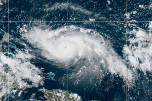
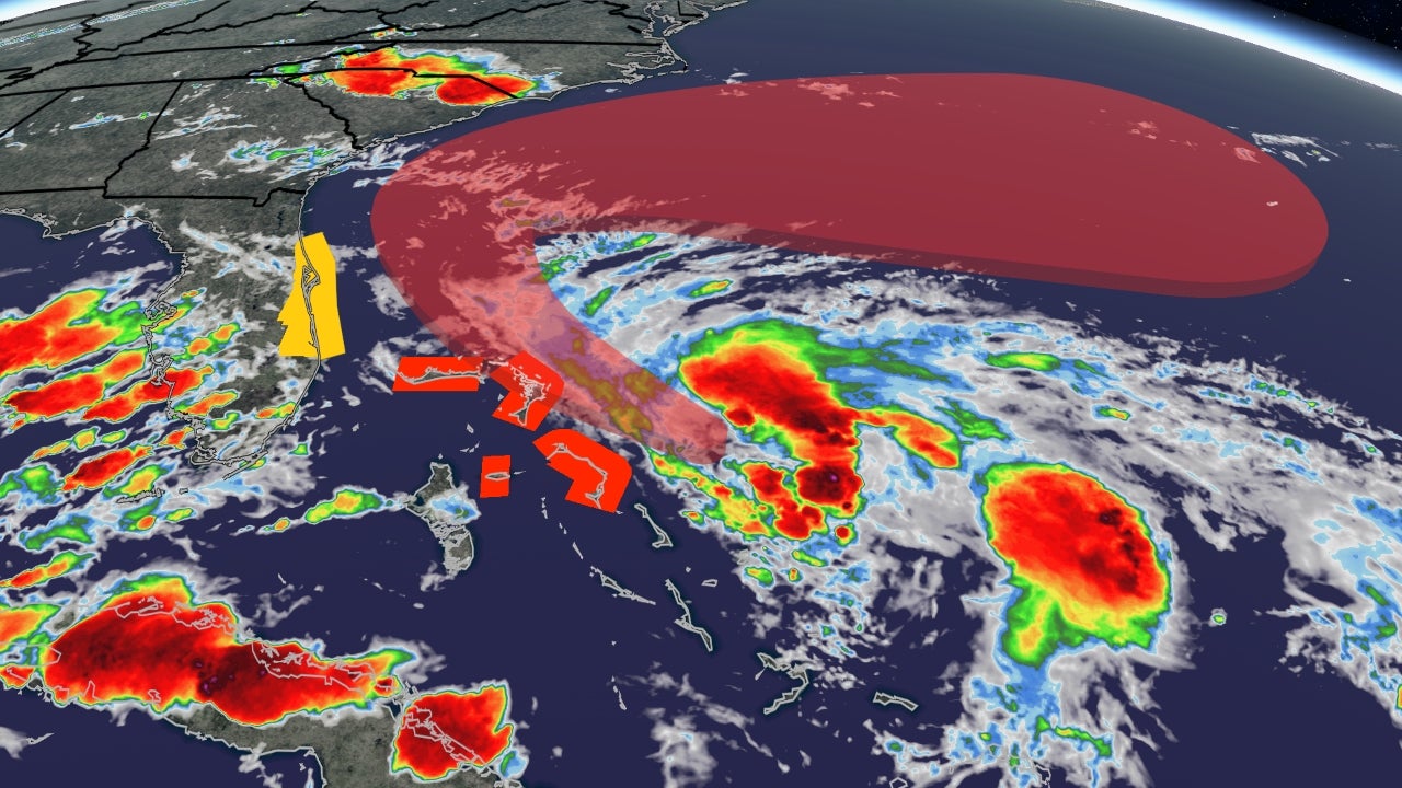
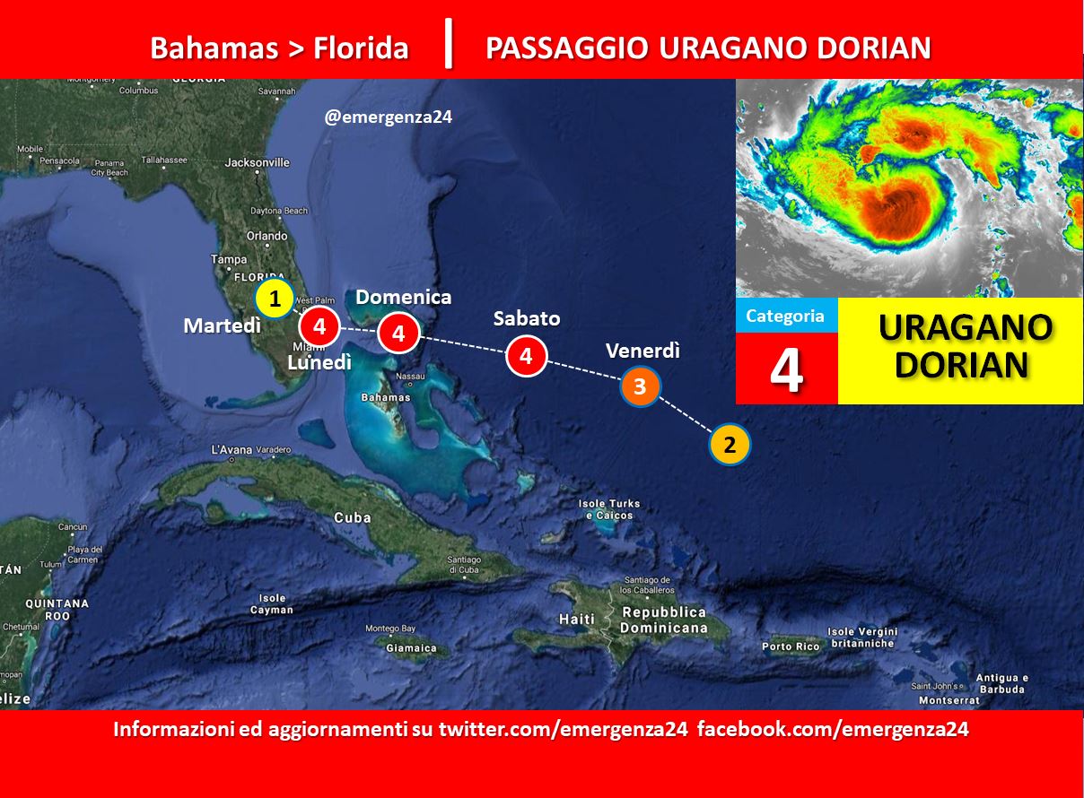
 A partire dall’ultima settimana di agosto 2019 si è sviluppato nell’Oceano Atlantico settentrionale una perturbazione classificata il 29.08.2019 come uragano di categoria 2. Il percorso prevede che impatterà sulle Bahamas nella giornata del 01.09.2019 e sulla Florida il 02.09.2019. Si teme che la forza dell’uragano possa creare notevoli danni.
Questo post sarà continuamente aggiornato fino alla conclusione dell’evento.
CRONOLOGIA INVERSA
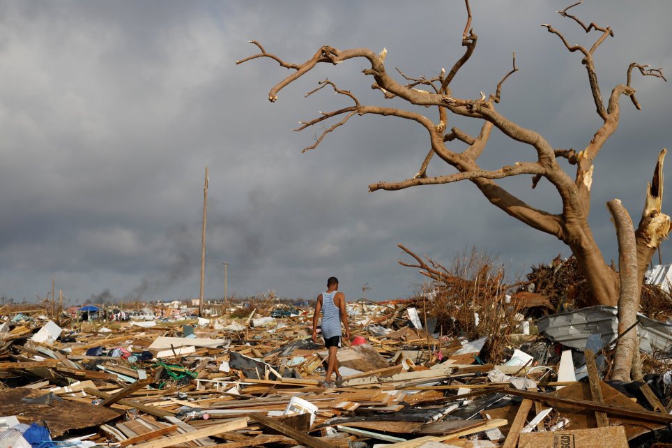
29.09.2019 – 12:00 – Aggiornato il bilancio delle vittime nelle Bahamas: +56 morti +600 dispersi.
17.09.2019 – 18:00 – Il bilancio è +52 morti e +1300 dispersi.
14.09.2019 – 12:00 – Il bilancio è +52 morti e +1300 dispersi. Si teme per una nuova depressione tropicale (la n.9) in arrivo nei prossimi giorni.
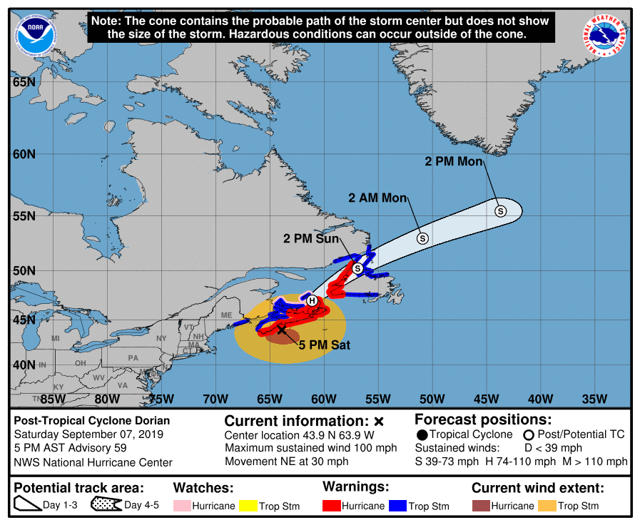
08.09.2019 – 01:00 – Quel che ne resta di Dorian si sta abbattendo sulla Nuova Scozia.
Dorian has lost it’s tropical characteristics but is still a powerful storm just exiting Nova Scotia. Next stop, Greenland as it continues to wind down. #wcvb pic.twitter.com/xWWyo9kX8L
— Mike Wankum (@MetMikeWCVB) September 7, 2019
05.09.2019 – 15:40 – Ultimi aggiornamenti
Hurricane #Dorian is slowly approaching the South Carolina coast. Heavy outer rain bands are occurring to the north with embedded tornadoes and strong winds.
A rare U.S. major hurricane landfall may happen today. Or, damn near close to it. pic.twitter.com/XgzdvK9AD2
— Ryan Maue (@RyanMaue) September 5, 2019
03.09.2019 – 18:00 – Ultimi aggiornamenti
In the northeastern United States, indirect impact from Dorian will ramp up in coastal areas such as Cape Cod, eastern Maine, Nova Scotia and New Brunswick: https://t.co/NXTmwodcBH pic.twitter.com/Rj1uxZij5d
— AccuWeather (@breakingweather) September 3, 2019
03.09.2019 – 16:00 – Dorian impatterà nelle aree costiere di Cape Cod, Maine, Nova Scotia e New Brunswick
In the northeastern United States, indirect impact from Dorian will ramp up in coastal areas such as Cape Cod, eastern Maine, Nova Scotia and New Brunswick: https://t.co/NXTmwodcBH pic.twitter.com/Rj1uxZij5d
— AccuWeather (@breakingweather) September 3, 2019
02.09.2019 – 12:00 – Ultimi oaggiornamenti
Dorian Stationary Over Grand Bahama; Move To The North Begins Tonight https://t.co/UAoysW3DQU pic.twitter.com/4W5F0ExH0t
— MyFoxHurricane.com (@myfoxhurricane) September 2, 2019
01.09.2019 – 22:00 – Sono segnalati danni estesi, strutturali ed allagamenti nelle Bahamas.
01.09.2019 – 20:00 – Immagini dalla ISS
Cameras outside the station captured views of #HurricaneDorian at 12:16 p.m. ET on Sept. 1 as it churned over the northern Bahamas. The storm is a dangerous Category 5 hurricane, carrying the strongest winds in recorded history for the northwestern Bahamas. #Hurricane #Dorian pic.twitter.com/ug0sdD5JOj
— Intl. Space Station (@Space_Station) September 1, 2019
01.09.2019 – 19:30 – Nell’isola di Elbow Cay il vento dell’uragano Dorian ha raggiunto i 295 km/h
01.09.2019 – 18:40 – Ultimi aggiornamenti
Wind distance from the center of the storm. Hurricane winds of 74 mph…now extend 45 miles from the center. Tropical Storm winds 39 miles mph…. now extend 140 miles from the center center! #askcbs12 pic.twitter.com/6giUoXWEVq
— chrisfarrellcbs (@ChrisFarrellcbs) September 1, 2019
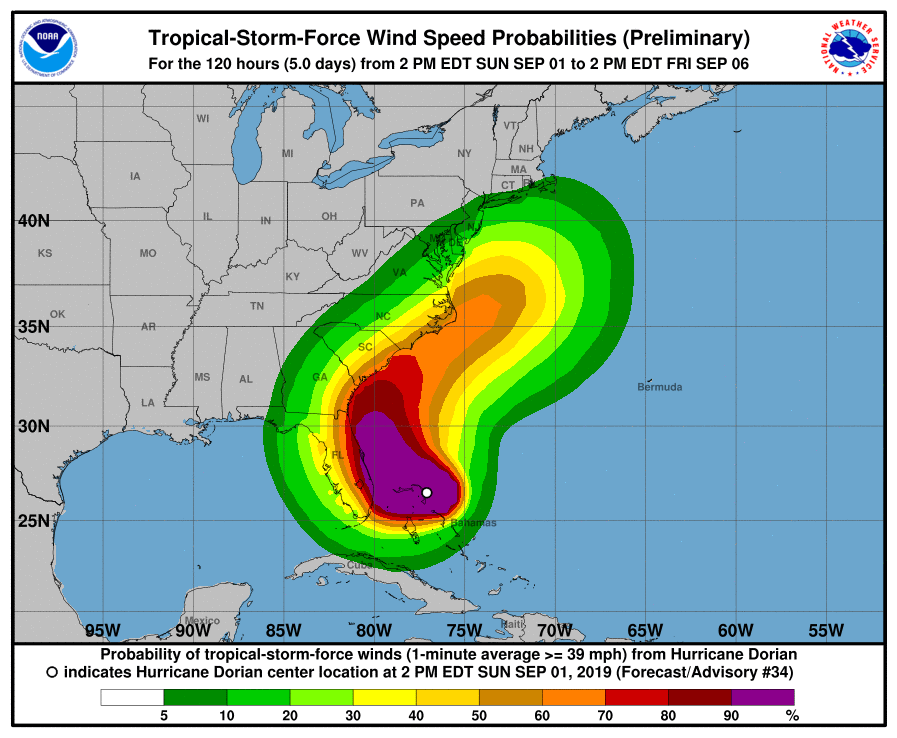
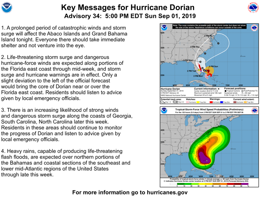
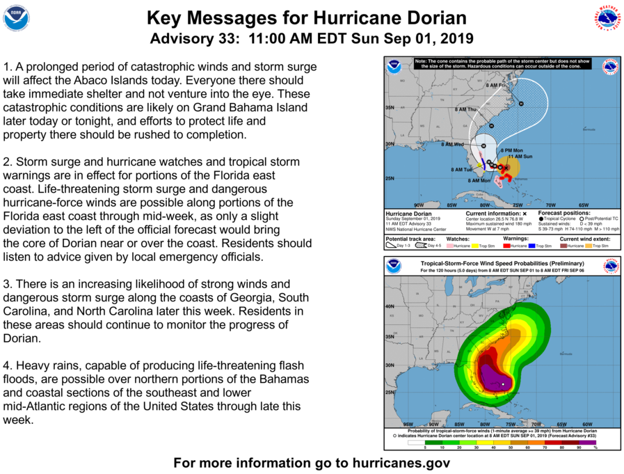
01.09.2019 – 18:00 – Ultimi aggiornamenti sul path dell’uragano.
Here are the latest Key Messages on Hurricane #Dorian. Storm surge and hurricane watches have been issued for portions of the Florida east coast. The latest full advisory is available at https://t.co/tW4KeFW0gB pic.twitter.com/d6VjAX38lA
— National Hurricane Center (@NHC_Atlantic) September 1, 2019
01.09.2019 – 17:00 – L’uragano ha raggiunto categoria 5
31.08.2019 – 22:00 – Ultime immagini GOES16
UPDATE: NOAA’s #GOES16 provides this “sandwich loop” animation — a combination of infrared & visible imagery — highlighting the ferocity of #HurricaneDorian. @NHC_Atlantic says the #hurricane is headed toward the northwest #Bahamas, with life-threatening storm surge & winds. pic.twitter.com/MF8tj8IE2S
— NOAA Satellites PA (@NOAASatellitePA) August 31, 2019
31.08.2019 – 16:00 – Ultimo aggiornamento
#NOAA20, America’s newest and most advanced polar-orbiting satellite, snapped this close up of the eye #HurricaneDorian2019 overnight. Updates on the dangerous, Cat. 4 #hurricane: @NHC_Atlantic pic.twitter.com/9QuhiwPPdC
— NOAA Satellites PA (@NOAASatellitePA) August 31, 2019
30.08.2019 – 20:00 – Ultimo aggiornamento
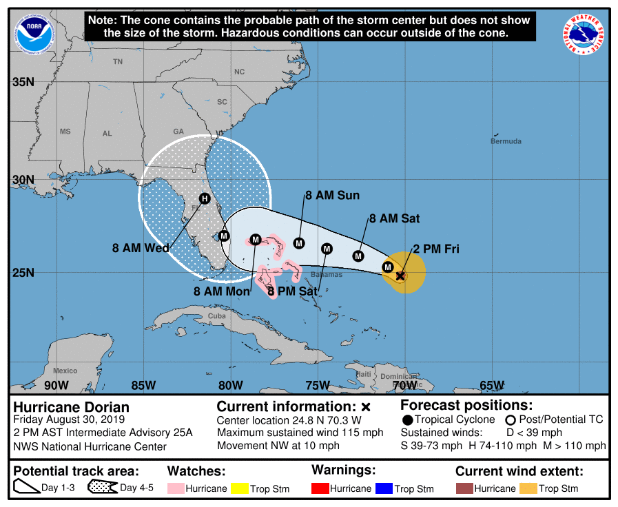
2 PM EDT: Hurricane Hunter aircraft finds #Dorian is now a major hurricane – poses a significant threat to Florida and the northwest Bahamas: https://t.co/W7hebQVNpu? pic.twitter.com/Z0b9ki11yX
— National Hurricane Center (@NHC_Atlantic) August 30, 2019
30.08.2019 – 19.30 – Ultimo aggiornamento
This false-colour @CopernicusEU #Sentinel3 image taken on 30 August during night hours shows #HurricaneDorian moving past Puerto Rico and heading towards #Florida.@NWSNHC warned that tropical-storm-force winds could reach parts of Florida as early as Sunday morning. pic.twitter.com/s7roMdWn0d
— ESA EarthObservation (@ESA_EO) August 30, 2019
30.08.2019 – 18:00 – Ultimo aggiornamento
Watch as the eye of #HurricaneDorian2019 begins to form in this 1-minute visible loop from NOAA’s #GOESEast. “Dangerous Hurricane #Dorian poses a significant threat to #Florida and the northwestern #Bahamas,” according to the @NHC_Atlantic. Latest: https://t.co/W7u6rft9x2 pic.twitter.com/AuDJst6smv
— NOAA Satellites (@NOAASatellites) August 30, 2019
30.08.2019 – 16:00 – Nuova immagine NOAA-NASA
NEW: Here’s an infrared image of #HurricaneDorian2019, captured overnight by the NOAA-NASA #SuomiNPP satellite. A #HurricaneWatch is in effect for the northwestern #Bahamas. For updates on #Dorian: @NHC_Atlantic pic.twitter.com/GCXC6W0DOR
— NOAA Satellites PA (@NOAASatellitePA) August 30, 2019
29.09.2019 – 23:00 – Le previsioni aggiornate del NOAA
There’s an increasing chance for #Dorian to bring a triple-threat of dangers to the Florida east coast…
🌊life-threatening storm surge
🌬️devastating hurricane-force winds
🌧️heavy rainsThe onset of tropical storm force winds could be as soon as Saturday evening.
Prepare NOW. pic.twitter.com/Moes49tcyu— National Weather Service (@NWS) August 29, 2019
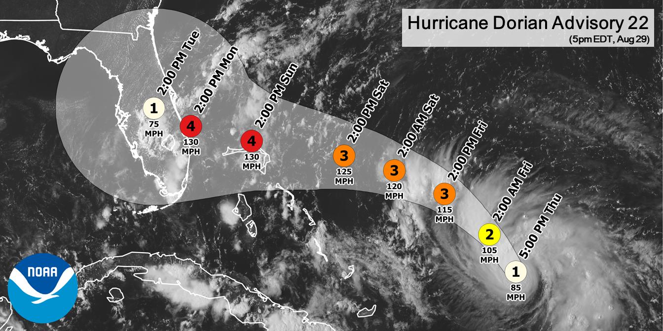
29.08.2019 – 22:00 – Animazione del percorso previsto e aggiornato
The first 21 advisories and five-day track outlooks for #HurricaneDorian have been consistent as shown below.
Everyone across #Florida should be prepared for #Dorian. @GregDeeWeather @SurfnWeatherman @IreneSans @JaniceHuff4ny @StuOstro
Imagery credit: https://t.co/skZL8LnWW8 pic.twitter.com/i40hbD7XEn
— GlobalWeatherClimate (@gwccwx) August 29, 2019
29.08.2019 – 20:30 – Il Governatore della Florida Ron DeSantis da dichiarato lo stato di emergenza in tutto lo stato per l’arrivo dell’uragano Dorian

 Leggi i