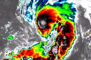
 Si è formata, intorno alla metà del mese di agosto, nell’Oceano Pacifico, una tempesta tropicale denominata Shanshan che dovrebbe passare a tifone nei prossimi giorni. Seguiremo l’evento fino al termine.
CRONOLOGIA INVERSA
28.08.2024 – 01:00 – Informazioni e aggiornamenti
#Shanshan continues to intensify beyond expectations. JMA is now predicting that its central pressure could drop to 925hPa and approach Kyushu. This is an extraordinary #typhoon. Since records began in 1951, the lowest pressure at landfall was 925hPa (Nancy, 1961). pic.twitter.com/Fy3EbvvbM4
— Sayaka Mori (@sayakasofiamori) August 27, 2024
28.08.2024 – 00:00 – Informazioni e aggiornamenti
Let’s try this again shall we, awaiting our flight to Kagoshima. The latest JMA track is very concerning, a powerful #typhoon #shanshan crawling but the west coast of Kyushu tomorrow. Hours and hours of atrocious weather and a huge flood threat. More updates once on location 🇯🇵 pic.twitter.com/a4j77FemsJ
— James Reynolds (@EarthUncutTV) August 27, 2024
27.08.2024 – 22:00 – Informazioni e aggiornamenti
Combined satellite and radar shows Typhoon #Shanshan moving slowly northward, but stalling and wobbling as it does so in a trochoidal motion. This can make predicting the exact path of the typhoon more challenging. #台風10号 pic.twitter.com/yktA7Xs38P
— Zoom Earth (@zoom_earth) August 27, 2024
27.08.2024 – 00:00 – Informazioni e aggiornamenti
Typhoon #Shanshan continues to strengthen and is now showing an eye in overnight infrared satellite imagery. #台風10号 pic.twitter.com/gETgfHAm88
— Zoom Earth (@zoom_earth) August 26, 2024
23.08.2024 – 20:00 – Informazioni e aggiornamenti
#Shanshan has quickly reached Category 1 Typhoon intensity, curling up with winds of 75 mph (120 km/h) and a minimum pressure of 983 mbar. Lustrous plumes of thunderstorms have been stubbornly firing near the center today as the storm battles some unfavorable atmospheric winds.… pic.twitter.com/bevJnjBDxg
— Backpirch Weather (@BackpirchCrew) August 23, 2024

 Leggi i