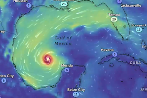
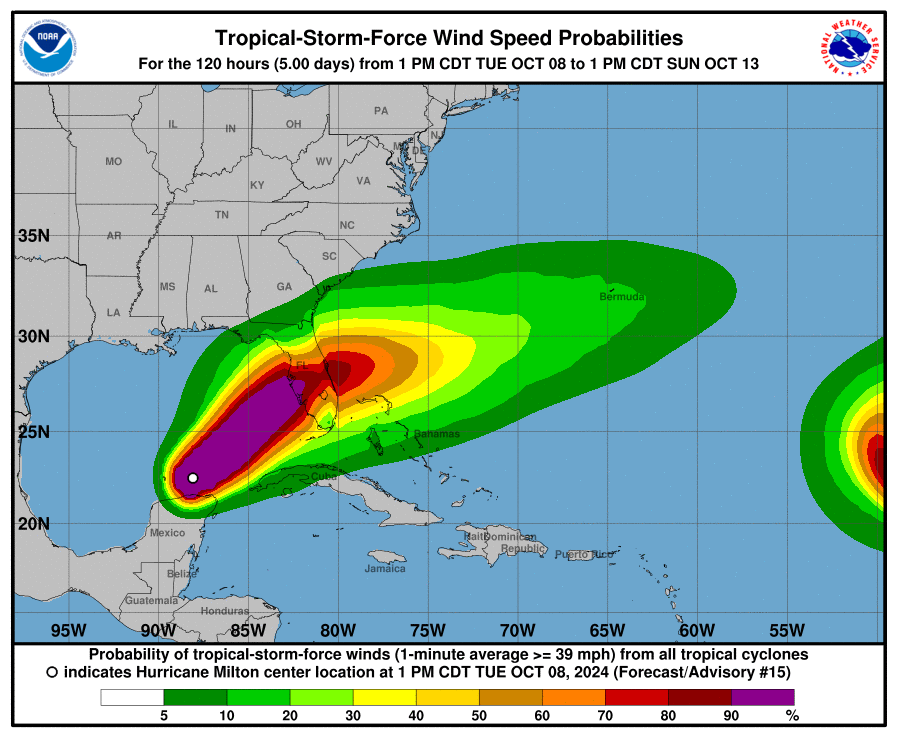
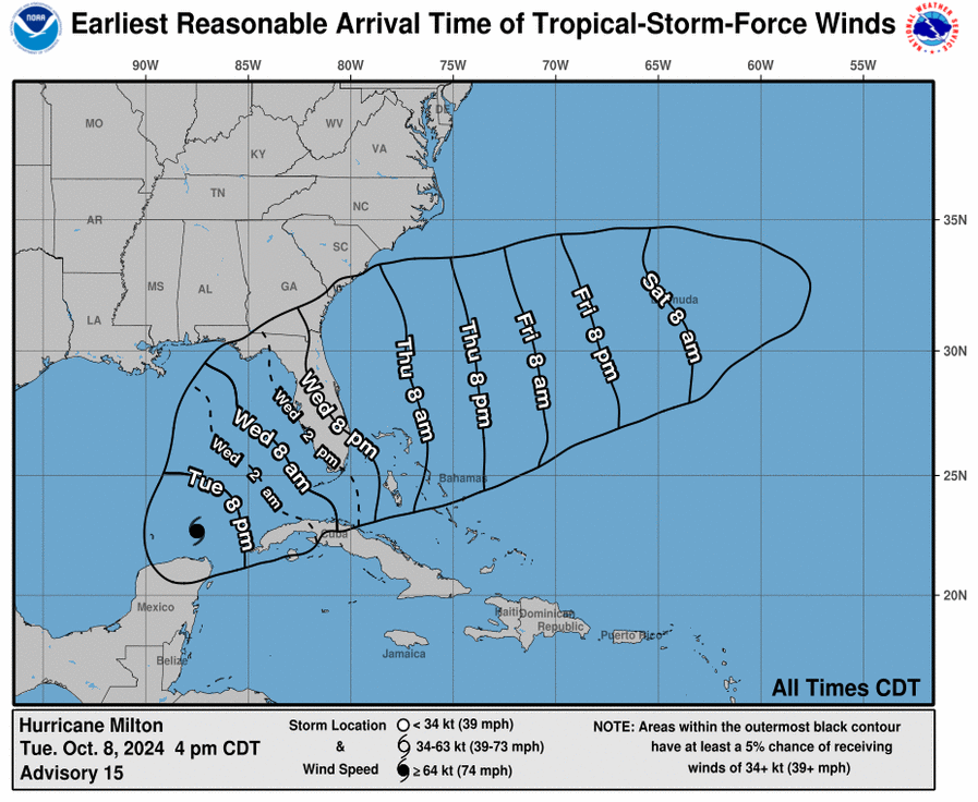
 Preoccupazione per la formazione nel Golfo del Messico del ciclone tropicale Milton (2024) che si è formato alla fine del mese di settembre 2024 e potrebbe toccare le coste della Florida (Tampa) il 09.10.2024 diventando un uragano (hurricane).
Questo post verrà aggiornato fino alla fine dell’evento.
CRONOLOGIA INVERSA
12.10.2024 – 20:00
Hurricane #MILTON’s complete track from formation to dissipation.
With a minimum pressure of 897 mb, MILTON is the 5th-most intense Atlantic hurricane on record, as well as the most intense since WILMA 2005. In the 24-hour period from 0z October 7 to 0z October 8, Milton went… pic.twitter.com/tLFn2TyQdK
— Michael Ferragamo (@FerragamoWx) October 12, 2024
10.10.2024 – 02:00
Continua la destrutturazione di Milton.
Dagli ultimi dati radar/aerei ha perso ancora intensità: 955 hPa; 175 km/h.Landfall tra cat2 e 3 entro un’ora
Irrilevante il calo per la marea che monterà rapidissima all’incedere dell’occhio; raggiungerà i 3 metri nelle zone più esposte pic.twitter.com/lWSXC5y0O5
— Daniele Vasilevski (@Daniele_V94) October 9, 2024
St. Petersburg tonight! pic.twitter.com/Mt6X5Tp4ht
— Mike's Weather Page (@tropicalupdate) October 9, 2024
Very sad situation now here in Sarasota looking out towards the outer barrier islands. Power flashes have now started dotting the sky, and Bird Key is being swallowed by extremely strong winds and storm surge as #Milton’s eye drifts slowly closer. #FLwx #HurricaneMilton pic.twitter.com/4hrNWSrKgi
— Ben McMillan (@WeatherLiveTV) October 9, 2024
POWER FLASHES: @JordanHallWX oobserves power flashes across Venice, Florida, as Hurricane #Milton's landfall is imminent. #flwx pic.twitter.com/vrqCh0acfJ
— MyRadar Weather (@MyRadarWX) October 9, 2024
10.10.2024 – 01:00
Storm surge is now pouring into Venice, Florida as hurricane #Milton inches closer to landfall this evening. Over 10 FEET of surge is possible here over the next few hours. pic.twitter.com/DS8EOLIwLO
— Bryce Shelton (@BryceShelton01) October 9, 2024
MAJOR STORM SURGE moving into Fort Myers Beach.
This is at Margaritaville facing north towards Times Square.
Beach Talk Radio#MILTON #flwx pic.twitter.com/dndDN7kVRB
— Dylan Federico (@DylanFedericoWX) October 9, 2024
10.10.2024 – 00:00
Our 403rd Operations Group Commander Col. Elissa Granderson was our pilot for today’s mission into #hurricanemilton2024
collecting weather data for NHC forecasts.
She is responsible for all matters pertaining to the operational readiness and effectiveness of the Operations… pic.twitter.com/5fgl9XLaDy
— Hurricane Hunters (@53rdWRS) October 9, 2024
09.10.2024 – 01:00 – Previsioni vento e accumulo
#Milton is the fastest Atlantic hurricane to intensify from a Tropical Depression to a Category 5 Hurricane, taking just over 48 hours. This animation shows Milton as it intensified, with the heaviest rains (red) concentrated near the center. https://t.co/uXpdGH1yEd pic.twitter.com/YWwrpgQcTe
— NASA Earth (@NASAEarth) October 8, 2024
09.10.2024 – 00:00 – Informazioni e aggiornamenti
Milton è di nuovo categoria 5.
Si tratta del terzo uragano atlantico con la più rapida transizione da tempesta tropicale a categoria 5 (in 24h). La pressione raggiunta (897 millibar) è la più bassa dal 2005 e la quinta più bassa mai registrata tra Atlantico e Golfo del Messico. pic.twitter.com/PqlrZqTj9y— Giulio Betti (@Giulio_Firenze) October 8, 2024
430pm CDT Oct 8th — Observations from the Air Force Reserve Hurricane Hunters (@53rdWRS) confirm that #Hurricane #Milton is a Category 5 hurricane with max sustained winds of 165 mph. The minimum central pressure was down to 905 mb (26.72 inches).
TCU: https://t.co/QFMVE0t85y pic.twitter.com/fYUsyunaGa
— National Hurricane Center (@NHC_Atlantic) October 8, 2024
08.10.2024- 23.00 – Informazioni e aggiornamenti
4pm CDT Oct 8th Key Messages for #Hurricane #Milton which has become a Category 5 hurricane again:
Large area of destructive storm surge expected along portion of west-central coast of #Florida Peninsula. If you are in a Storm Surge Warning area, please evacuate if told by local… pic.twitter.com/JRNnFfKLu5
— National Hurricane Center (@NHC_Atlantic) October 8, 2024
08.10.2024 – 22:00 – Informazioni e aggiornamenti
#MILTON is probably a Category 5 again. Frequent lightning in the eye wall is a sign of rapid intensification. Classic donut shape with a stadium-effect eye. IMO Milton's current satellite presentation is more impressive than yesterday's peak. pic.twitter.com/3pgKIjq9V8
— Dylan Federico (@DylanFedericoWX) October 8, 2024
Our #whindex status maps reflect our closures as of 2pm today in advance of #HurricaneMilton. More updates to come. Please stay safe.
**Due to the potential for variations in Milton's path, this information is subject to change without notice. Please follow local guidance. pic.twitter.com/AWig09L8bP
— Waffle House (@WaffleHouse) October 8, 2024
Hurricane #Milton almost back to Category 5 with sustained winds of 155mph or 249kmh! I really hope the people of Florida are taking this seriously. pic.twitter.com/7g7khDp7kb
— Carlow Weather (@CarlowWeather) October 8, 2024
08.10.2024 – 21:00 – Informazioni e aggiornamenti
BREAKING: The storm surge for Hurricane Milton is expected to be 15 feet.
To give you an idea of how deadly this is, here's what 9 feet looks like:pic.twitter.com/0SxfrA9XK3 https://t.co/56ZLtpOIbi
— Financelot (@FinanceLancelot) October 8, 2024
08.10.2024 – 20:00 – Informazioni e aggiornamenti
Storm surge is deadly. Do not risk your life.
If you are in the path of Hurricane #Milton, stay away from coastal areas & evacuate if asked to do so. The urgency of the moment is upon us. pic.twitter.com/uvfGQgnBnO
— FEMA (@fema) October 8, 2024
Big time slow downs on Alligator Alley, i-75 out of Naples, Florida this afternoon as the mass evacuation continues ahead of Hurricane #Milton. pic.twitter.com/JZoQHfHTlb
— Bryce Shelton (@BryceShelton01) October 8, 2024
08.10.2024 – 16:00 – Informazioni e aggiornamenti
TPA IS NOW CLOSED: TPA suspended operations at 9 a.m. Tuesday in preparation for Hurricane Milton.
Airport staff are now securing the airfield, terminals, jet bridges and ground equipment.
LEARN MORE
https://t.co/odKichk1XX pic.twitter.com/bJ9bHkZJfK
— Tampa International Airport
(@FlyTPA) October 8, 2024
07.10.2024 – 02:00 – Informazioni e aggiornamenti
Latest National Hurricane Center advisory and forecast track for Hurricane Milton. #Milton #HurricaneMilton #FLwx https://t.co/fFTgmQYBp4 pic.twitter.com/JxdE5WhrW0
— Rob Perillo (@robperillo) October 7, 2024
08.10.2024 – 00:00 – Informazioni e aggiornamenti
Hurricane Milton intensifies further with sustained winds now up to 180 mph and central pressure down to 905 mb.
You are looking at one of the strongest hurricanes ever observed in the Atlantic basin. pic.twitter.com/woc4iBYABk
— Nahel Belgherze (@WxNB_) October 7, 2024
07.10.2024 -01:00 – Informazioni e aggiornamenti
Fort Myers Beach, FL issues a full island evacuation by 3 PM Monday. The @NHC_Atlantic guidance for storm surge inundation from #Milton is in the red “greater than 9 foot” range for the whole island.@weatherchannel for the latest information before, during and after the storm
pic.twitter.com/gjAXhnnzml
— Justin Michaels (@JMichaelsNews) October 6, 2024
06.10.2024 – 23:00 – Informazioni e aggiornamenti
Hurricane #Milton is now forecast to peak as a 145 mph Category 4 Hurricane, before potentially making landfall in Sarasota with winds of 120 mph. This is becoming an increasingly dangerous situation for #Florida’s West Coast.
(Sat-image credit: cyclonicwx) pic.twitter.com/58yaMoTn3d
— Backpirch Weather (@BackpirchCrew) October 6, 2024
The Town of Fort Myers Beach has issued a Mandatory Evacuation for the entire Island.
We encourage residents and business owners to make a plan, to be evacuated by 3:00pm, on Monday, October 7, 2024. pic.twitter.com/g2mEa05RSU
— TownofFortMyersBeach (@TownofFMB) October 6, 2024
06.10.2024 – 03:00 – Informazioni e aggiornamenti
Latest Saturday night 18z Hurricane models coming in. 928, 942, 943, 962mb. Still very strong midweek’ish. https://t.co/Hk3pbO84Yf pic.twitter.com/1uAKXJgR2G
— Mike’s Weather Page (@tropicalupdate) October 6, 2024
06.10.2024 – 00:00 – Informazioni e aggiornamenti
5 PM Sat: NHC is issuing advisories on #Milton. Milton is expected to be a large storm with impacts extending well away from the storm’s center. Southeast GA & SC may experience windy conditions, rounds of rainfall, dangerous rip currents/surf, & coastal flooding Wed thru Thurs. pic.twitter.com/svknd1TUEw
— NWS Charleston, SC (@NWSCharlestonSC) October 5, 2024
05.10.2024 – 23:00 – Informazioni e aggiornamenti
#Milton is now forecast to become a Category 3 Major Hurricane before striking the west coast of the Florida Peninsula on Wednesday. pic.twitter.com/Mqu1VwODmO
— Zoom Earth (@zoom_earth) October 5, 2024


 Leggi i