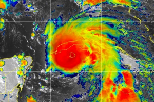
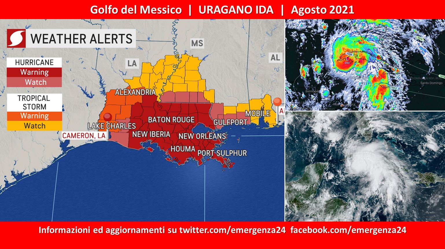
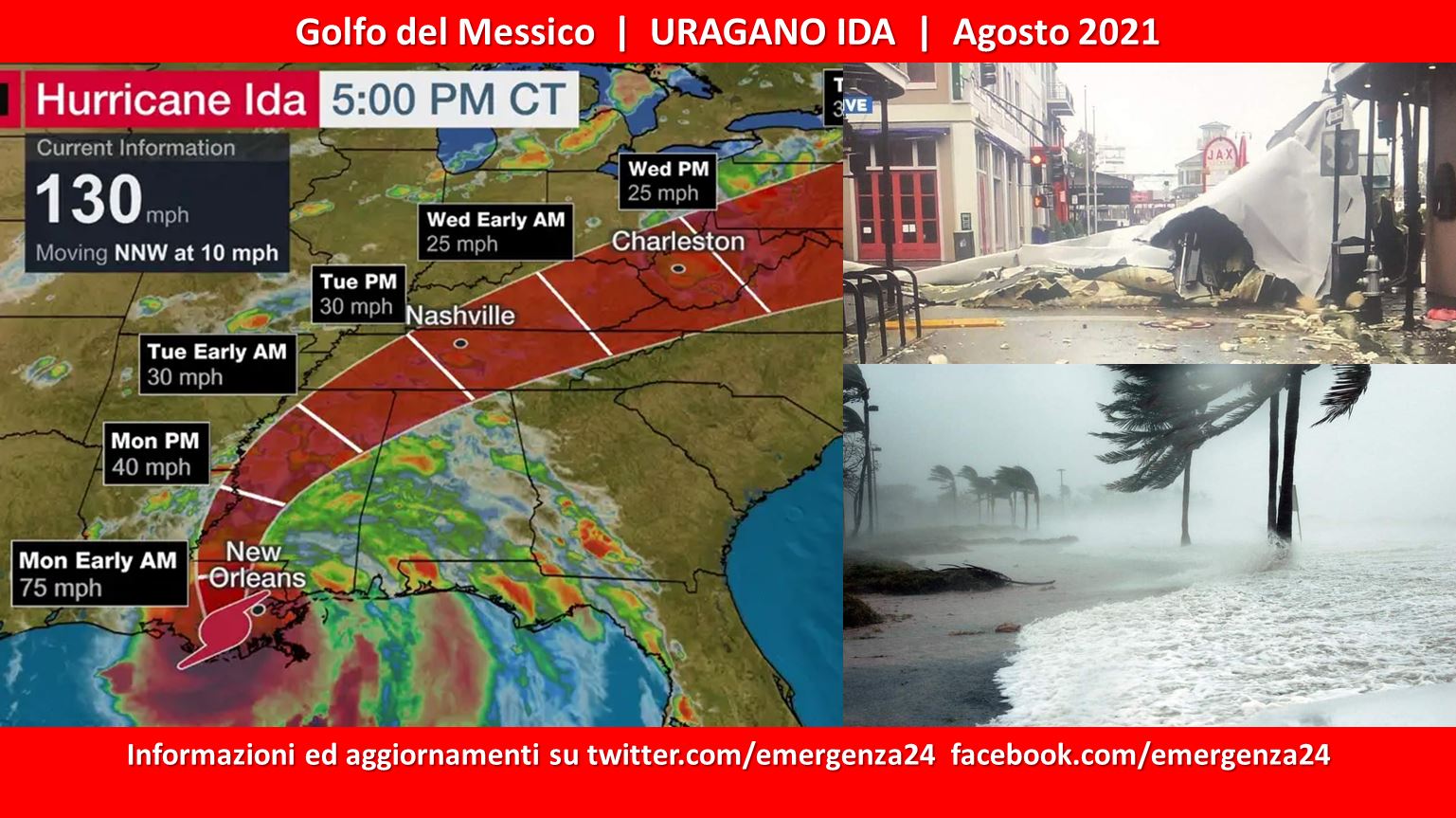
 A partire dal 21.08.2021 si è formata una perturbazione tra Giamaica e Haiti che a partire dal 26.08.2021 si è trasformata in un uragano denominato Ida.
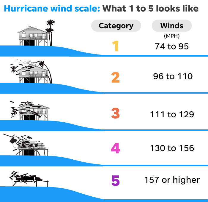
L’uragano Ida raggiungerà la costa USA con una categoria 3 a partire dal 29.08.2021 dopo aver raggiunto nelle ore precedenti una categoria 4. L’orario della Louisiana è (GMT-5) quindi rispetto all’Italia (UTC+1) bisogna togliere 7 ore. Gli orari indicati di seguito sono italiani (UTC+1). Vedi la scala degli uragani Saffir-Simpson.
CRONOLOGIA INVERSA
30.08.2021 – 00:00 – Aggiornamenti, mappe, path
29.08.2021 – 23:00 – Aggiornamenti, mappe, path
ABSOLUTELY HORRIBLE: Hurricane Ida ripped the roof off Lady of the Sea Hospital in Galliano >> https://t.co/VQAkpMOUpL pic.twitter.com/e3WZMaw1bE
— wdsu (@wdsu) August 29, 2021
29.08.2021 – 22:00 – Aggiornamenti, mappe, path
Hurricane Ida has entered an extended “landphoon phase” where it feeds off the latent and sensible heat of the Louisiana Bayou swamps. It will trudge northward dumping untold amounts of rain. pic.twitter.com/kae4RDwVcm
— Ryan Maue (@RyanMaue) August 29, 2021
Massive roof launched with wind gust and hit this power pole in front of Dominator Fore and I can’t even put into words how much worse tbis is going to get in Houma with inner eye wall of Hurricane Ida approaching rapidly @RadarOmega @accuweather pic.twitter.com/DBzFfuCdvh
— Reed Timmer (@ReedTimmerAccu) August 29, 2021
29.08.2021 – 20:00 – Uragano Ida arrivato a Port Fourchon in Louisiana con categoria 4.
#Ida a touché terre en début d’après-midi à Port Fourchon alors que l’ouragan était de catégorie 4 avec des vents soutenus de 240 km/h. La @NHC_Atlantic s’attend à ce que jusqu’à 500 mm de pluie tombent localement en Louisiane #mm pic.twitter.com/nNSWUKjt1R
— Félix Biron (@FelixBiron_MM) August 29, 2021
29.08.2021 – 17:00 – Aggiornamenti, mappe e path
Dauphin Island… photos from Dale Snellman pic.twitter.com/JAdLO0Qf5j
— James Spann (@spann) August 29, 2021
29.08.2021 – 15:00 – Aggiornamenti, mappe e path
HURRICANE IDA IMPACT: Here is a look at the storm surge in Grand Isle pic.twitter.com/BSOuy0ye0b
— wdsu (@wdsu) August 29, 2021
#Ida is still a very powerful and extremely dangerous Category 4 storm with maximum sustained winds at 150 mph.
We’re live in the studio and out in the field to bring you the latest on what will likely be a devastating storm for many. pic.twitter.com/LSWwnMoj3M
— The Weather Channel (@weatherchannel) August 29, 2021
150mph Hurricane #Ida on approach. Yet another hurricane hitting at its strongest…we have unfortunately seen this several times in recent years pic.twitter.com/VC47qNmi4N
— Eric Fisher (@ericfisher) August 29, 2021
Hurricane Ida rapidly intensified overnight with max wind speeds of 140mph near the eye wall. The pressure has dropped below 950mb and is only a little over 60 miles off of the Louisiana coastline. https://t.co/8PEkdfmuNh
-Eric pic.twitter.com/47iRX0Yvav
— FOX6 Weather (@FOX6Weather) August 29, 2021
29.08.2021 – 13:00 – Aggiornamenti, mappe e path
As of the 6am CDT @NHC_Atlantic update, #Ida’s sustained winds are now 150mph, with a central pressure of 935mb.
*link to full update: https://t.co/PN4t4ulJzQ?
*Loop from 920pm-540am CDT pic.twitter.com/w0Wg5nzCWq
— National Weather Service (@NWS) August 29, 2021
Ida is now an extremely dangerous Category 4 Hurricane this morning over the northern Gulf of Mexico. Ida will likely make landfall this afternoon along the SE LA coast as a Major Hurricane. https://t.co/RSaaqH4lXr pic.twitter.com/RynYU8TLjq
— WLBT 3 On Your Side (@WLBT) August 29, 2021
29.08.2021 – 01:00 – Aggiornamenti, mappe e path
As of 4 p.m. CDT, Hurricane Ida was located in the southeastern Gulf of Mexico and was moving northwest at 16 mph. Hurricane-force winds extended outward 30 miles from the storm’s center and tropical-storm-force winds extended outward 125 miles. https://t.co/sKkviRUNEv
— AccuWeather (@accuweather) August 28, 2021
29.08.2021 – 00:00 – Aggiornamenti, mappe e path
Hurricane #Ida is looking powerful as a Category 2 hurricane making its way towards the Louisiana coast for landfall tomorrow.
Here’s minute-by-minute visible satellite and LWIR satellite imagery side by side (soon to be released).
All subscribers have access to satellite. pic.twitter.com/NdpdgYKoFQ
— RadarOmega (@RadarOmega) August 28, 2021
28.08.2021 – 23:30 – Aggiornamenti, mappe e path
This composite imagery is called a “sandwich” loop, and it is made by combining visible and infrared satellite imagery channels. The resulting multi-dimensional image gives meteorologists and researchers additional insight into severe weather, such as #Hurricane #Ida, below. pic.twitter.com/ojOE5xaKKe
— NOAA Satellites (@NOAASatellites) August 28, 2021
Ida still expected to move onto the Louisiana coast tomorrow as a very dangerous, major hurricane. The main wind and storm surge issues will be along and east of the center of circulation; keep in mind wind, and rainfall impacts will extend far from the center. pic.twitter.com/pHruhxuUdt
— James Spann (@spann) August 28, 2021
28.08.2021 – 23:00 – Aggiornamenti, mappe e path.
JUST IN: Latest advisory for #Ida. Watch @NBCNewYork for the latest forecast. pic.twitter.com/DrVGcR5tU1
— Storm Team 4 NY (@StormTeam4NY) August 28, 2021
#NewOrleans: The Louis Armstrong Int’ Airport is packed with people at the TSA checkpoint up and around a set of stairs of people attempting to evacuate prior to #Ida’s landfall. pic.twitter.com/ZW7bRFQil3
— LLN Boston | Jack (@LLN_Boston) August 28, 2021
#HurricaneIda maintains Category 2 strength at the 5 PM ET updates. Winds have increased slightly to sustained at 105 mph in the core of the storm. #Ida is expected to impact the Gulf Coast as a Major Hurricane Sunday afternoon #LAwx pic.twitter.com/l3lGPyFLch
— WeatherNation (@WeatherNation) August 28, 2021
28.08.2021 – 22:00 – Aggiornamenti, mappe e path
Here’s a minute-by-minute look at #Ida since about 11:30AM CDT using quad-view satellite.
Still in a testing phase, but too good not to share. @RadarOmega pic.twitter.com/BS4W0jIzRv
— Lilly Herrington (@lilly_wx) August 28, 2021
28.08.2021 – 18:00 – Aggiornamenti, mappe e path
#Hurricane #Ida is strengthening in the Gulf right now.
NHC: “extremely life-threatening inundation of 9 feet or greater” of storm surge is possible” & “Potentially catastrophic wind damage possible where the core of Ida moves onshore”
We’ll have updates all day on AccuWeather pic.twitter.com/BLazcjBvrt
— Bill Wadell (@BillWadell) August 28, 2021
28.08.2021 – 00:30 – Aggiornamenti, mappe e path.
A few new visualizations for the NHC forecast for #Hurricane #Ida.
Derived track density in the shading, and forecast track color-filled by forward speed (@AlexJLamers) on the left, and wind intensity change on the right. pic.twitter.com/souQVI4Vii
— Sam Lillo (@splillo) August 27, 2021
28.08.2021 – 00:00 – Aggiornamenti, mappe e path.
Due to the expected size and power of Hurricane Ida, Gulf of Mexico waters will rise well in advance of the storm’s arrival near the coast, which is expected later Sunday or Sunday night. Forecasters caution that bay, lake, and bayou water levels will increase as well. pic.twitter.com/5xhzMUtPjE
— AccuWeather (@accuweather) August 27, 2021
27.08.2021 – 22:00 – Aggiornamenti, mappe e path.
AccuWeather forecasters warn that Hurricane Ida is likely to rapidly intensify and could even approach the U.S. coast as Category 4 hurricane. https://t.co/lmXDEWpKE5
— AccuWeather (@accuweather) August 27, 2021
27.08.2021 – 21:00 – Il Presidente Biden ha dichiarato lo stato di emergenza per la Louisiana.
27.08.2021 – 17:30 – Le previsioni portano a ritenere che sulla costa USA l’uragano Ida si presenti in Categoria 4
#Ida is forecast to be a major hurricane (Category 3) by the time it reaches the Gulf Coast on Sunday.
We’re LIVE helping you get prepared. Don’t underestimate this storm! pic.twitter.com/eIfskqfTCe
— The Weather Channel (@weatherchannel) August 27, 2021


 Leggi i