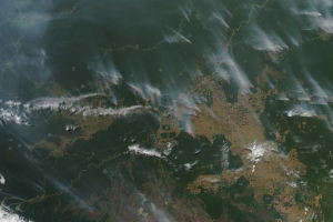
 Una serie di incendi boschivi sono stati segnalati a partire dal mese di Giugno con una intensificazione dai primi giorni di Agosto 2019 nella Foresta Amazzonica negli stati del Brasile, Perù e Colombia. Questi incendi sono consueti e di norma hanno la massima attività all’inizio di settembre per estinguersi a novembre (fonte).
Leggi l’approfondimento di Giorgio Vacchiano.
CRONOLOGIA INVERSA
22:00 – 29.08.2019 – Immagini da satellite degli incendi attivi in Brasile
UPDATE: NOAA’s #GOES16 continues tracking #smoke blowing across #Brazil from #fires in the #AmazonRainforest this afternoon. pic.twitter.com/c4Y9OM1CYc
— NOAA Satellites PA (@NOAASatellitePA) August 29, 2019
25.08.2019 – 01:00 – CNN riporta dati del National Institute for Space Research (sito). Il sito, la pagina Facebook e l’account Twitter dell’istituto non solo non riporta la notizia della CNN ma non ha nemmeno un approfondimento sugli incendi.
The number of fires in Brazil are 80% higher than last year, according to Brazil’s space research center. More than half of those are in the Amazon region — spelling disaster for the local environment and ecology. https://t.co/kMyZ2GLwCl
— CNN (@CNN) August 24, 2019
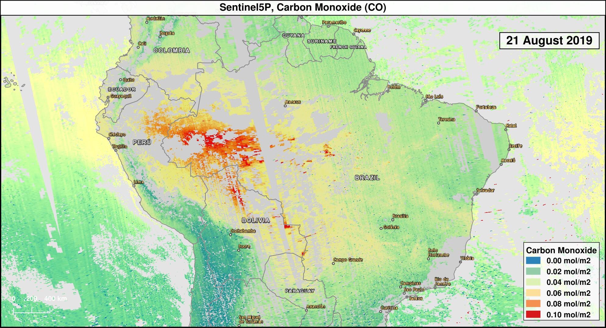
23.08.2019 – 21:00 – Mappa satellitare con andamento CO
#Wildfires 🔥 aren’t just a direct threat to ecosystems. They contribute to #climatechange and cause health risks by releasing pollutants
Satellites 🛰 help track them. Below are the carbon monoxide levels from the #Amazon & #Bolivia fires, measured by @CopernicusEU on 21 August pic.twitter.com/rYluCpjjxP
— WMO | OMM (@WMO) August 23, 2019
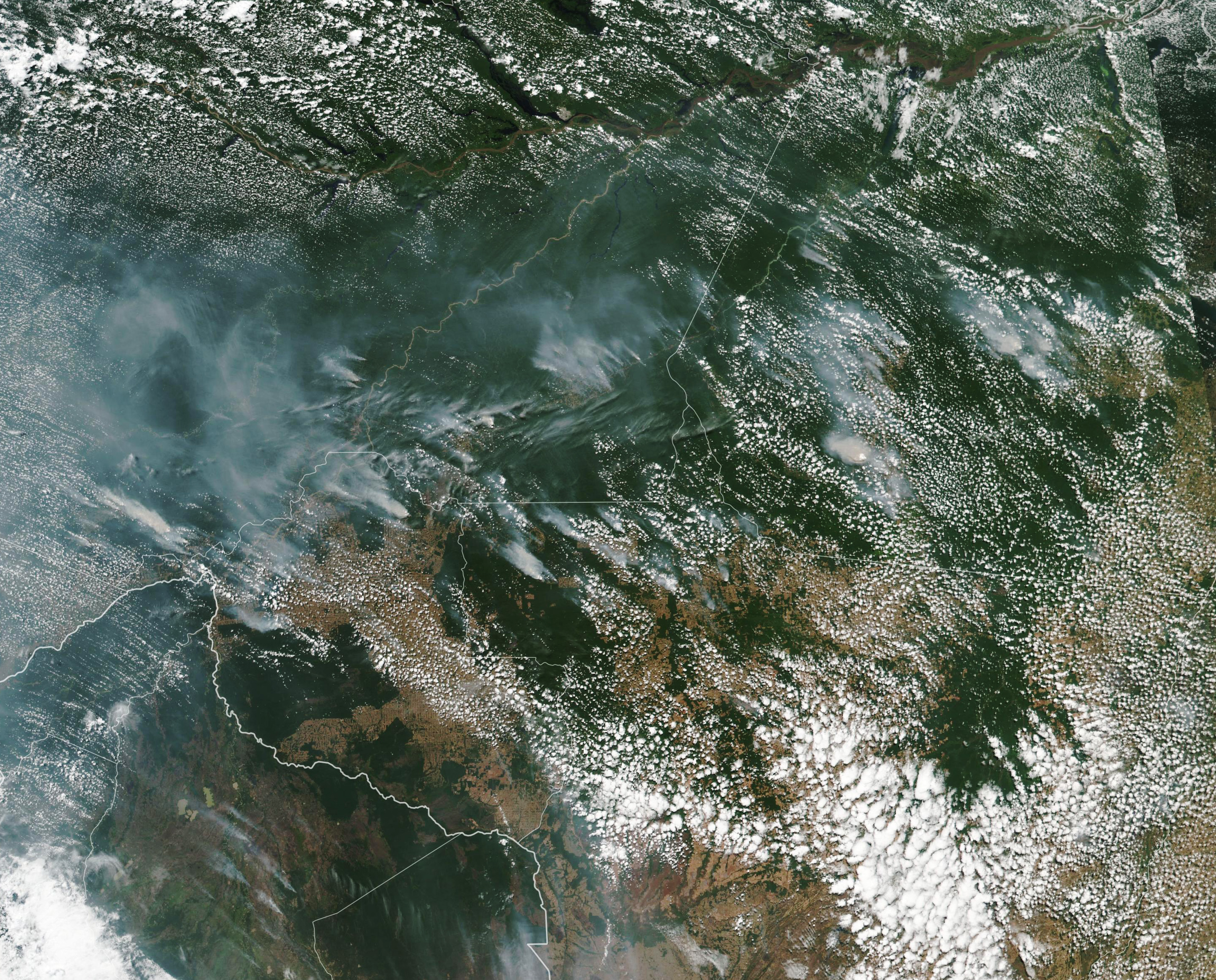
22.08.2019 – 20:00 – La NASA riporta che gli incendi nell’area sono nella media degli ultimi 15 anni e quindi non ci sarebbero aumenti rispetto agli anni precedenti: “As of August 16, 2019, an analysis of NASA satellite data indicated that total fire activity across the Amazon basin this year has been close to the average in comparison to the past 15 years.” Fonte: NASA Earth Observatory. Su questa posizione leggere anche qui.

Immagini 16.08.2019 – Fonte: eoimages.gsfc.nasa.gov
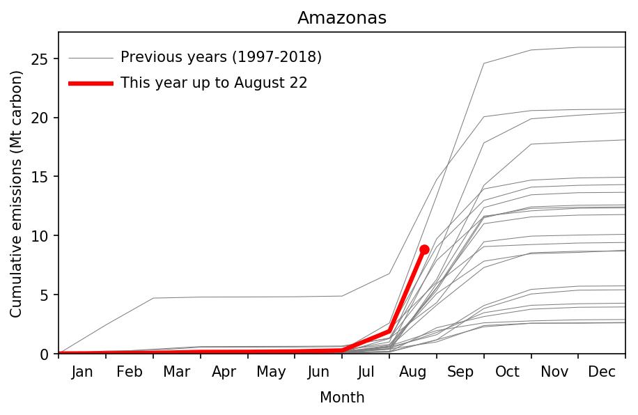
22.08.2019 – 13:00 – Dati sul numero ed estensione degli incendi
Update on Brazilian #wildfires that have been in the news a lot because of increased #deforestation there. Our Global Fire Emissions Database (GFED) based on #NASA satellite data confirms high fire activity in state of Amazonas. However … pic.twitter.com/cvDfWq1NeU
— Guido van der Werf (@GuidovanderWerf) August 22, 2019


 Leggi i